Pages

Labels

Monday, December 29, 2014

Holiday SOTA Activations

So here we are, another year has past, and it seems, at warp speed. I hope each of you are enjoying the holiday season, however you celebrate it. Our family celebrates Christmas and I was able to spoil my grandchildren, so it has been fun indeed. Happy New Year as we approach 2015, and may you have health and happiness.

I am spending a few days at my Santa Fe, NM QTH for the holidays. There is snow on the ground and its only been above freezing about 3 hours since last Friday. However its a dry cold so its not too bad.

As always when I'm here I try to squeeze in some Summits on the Air (SOTA) activations. So far I've been able to do a couple as detailed below.

The Wagon Mound W5N/EL-016  6,930ft ASL  6 pts

The Wagon Mound gets its name from it's appearance. Without too much imagination you can see the outline of an old Conestoga Wagon on the summit outline. I chose this summit primarily because I've never done it, but also because, for the peaks in the area, it is at a relatively low elevation and the snow cover should be much less than higher peaks. When I departed Santa Fe, it was clear, sunny and 19F. I envisioned very thin snow cover, if any, on the mountain.

I was in for a little surprise, as you will see from the video below.


Wagon Mound, NM is 104 miles northeast of my QTH near Lamy, NM. About half way there we encountered fog. Visibility dropped, at times, to about 50 yards and the temperature dropped to 7F. I was beginning to have my doubts about making the climb. It was obvious that the snow accumulations were significantly more here, than back home. However I continued, postponing my decision until I could see the actual conditions at the base of the mountain..

Upon arrival, conditions had improved a little, visibility to 1 mile and the temperature was 13F at the base of the mountain. It wasn't a long climb, but it was steep. There was about 12 inches of snow on the ground. The problem with that is that this climb was a bushwhack over volcanic rocks and cactus. The snow cover completely disguised what might or might not be underneath. I decided to make the attempt. Cris, my XYL, was with me and she was willing to try as well. After all, we had just come over 100 miles.

The footing was treacherous. I had to plant my foot through the snow to discover what footing was below, whether solid ground or slippery rocks.We took our time and turned what should have been a 20 minute climb into about 40 minutes.

We set up about 30 feet below the summit, well into the activation zone. I used my KX3, 31 ft. piece of wire elevated with a 21 foot mast through a 9 to 1 balun, tuned by the KX3's tuner. Despite weather conditions, propagation was very good. I worked 31 stations on 20m CW in 18 minutes, a quick QSY to 40m yielded no results and since it was cold I didn't try any other bands. We packed up and retraced our steps down.

All in all a very satisfying activation given the challenges. We stopped on our way home in Las Vegas, NM and warmed ourselves up with some Mexican Food. A good day.

Summit 6860 W5N/SI-022  6,860ft ASL  6 pts

After my experience heading north, I decided to go south for my next activation. This summit is east of Albuquerque NM just south of I-40 and 67 miles from my QTH. This is a nice summit. Depending on where you start, the hike is 2. to 3 miles round trip. The elevation change is about 800 feet over that distance. There are numerous crisscrossing trails over the terrain, so there are multiple ways to get to summit. The trails are all nice trails, no bushwhacking required on this one.

The weather was near perfect for climbing, about 40 degrees, sunshine and little wind. Very enjoyable. You will see from the video below that the conditions were splendid and there was a little snow on the ground.


I used the same set-up here as described above. Conditions were good, 31 QSO's on 15, 20, and 30 meters.

So 12 more points in the log and some good exercise and, obviously, some stories to tell.

Happy New Year!!


Sunday, December 7, 2014

Tromelin, Andamans and SOTA

It's been a while since I've sit down to write down a few thoughts. I've intended on several occasions to sit down and write down my thoughts, but it seems some other priority asserts itself and I can't get the time to write. But not today.

So what's happened since I last blogged.

Tromelin Expedition FT4TA: The expedition team did a great job, making nearly all bands available with good signals, at least in South Texas. I enjoyed both working the expedition, to fill some band slots, but also the event. The daily news, conditions, the complaining, etc.... I worked them on 10m, 15m, 20m, 30m and 80m. All new bands except 20m. My practice, as I have written about here, is to try to work the expeditions, during the last days, QRP. I was not able to do that on this expedition. The pile-ups never really slacked off, which brings me to my point.

Now that many expeditions use Club Log and other online tools to post how many QSO's each caller has logged, the information is leading to much debate. I am on a particular reflector where an individual copied and posted the band scorecard for multiple individuals and berated them for making multiple band/mode contacts when so many needed Tromelin for an all time new one.

My thoughts on this one: As long as an individual doesn't dupe band/mode slots, working the expedition is fair game. If a DXer builds a station that is capable and puts in the time operating to work Tromelin on 20 band slots, why not. Telling him not to is like telling a guy with a Ferrari that he can only drive the speed limit.  If, for whatever reason, a dipole is all you have, you know that working rare DX is a tough proposition. Why should the capable stations be made to wait on those not so capable. In my early days of DXing, not working an expedition motivated me to improve my station, improve my operating skills, improve my understanding of propagation, etc... Failure is often life's greatest teacher.

DX-peditions can control this somewhat by limiting the number of bands they operate on, but those guys paid their money, why shouldn't they have all the fun they can.

Andamans VU4CB and VU4KV:  This team also did a nice job activating a pretty rare place, that from my part of the world, is difficult to work.  I was able to get QSO's on a few bands and was impressed with the operation. I was not able to work these guys on QRP either. VU4VB operated from a rare IOTA which I also chased. So, please all around on this one.

SOTA Activations: I did find time to get in four SOTA activations near my Santa Fe, NM QTH during November. I activated three peaks, along with Fred KT5X and John K1JD, southeast of Albuquerque, NM.

Summit 8455 W5N/EL-002

This was a full day of activating. The first peak was a 100 mile drive, but well worth it. All of the three peaks were in excess of 8,000 feet. The picture above is of the first summit we activated, about a mile hike to the top. You can see from the pictures that a wildfire some years ago delineates our path to the top.

View from 8455

The reward, besides activator points, from being involved in SOTA, are the views.

More Views

The additional points achieved from these activations moved me to a total of 719 points in my quest to get to a 1,000 and earn the esteemed title of "SOTA Goat"

I love this radio stuff.....Until next time...73

Thursday, November 6, 2014

My Band's New CD

Sorry for a little off topic personal promotion. I've been busy the last few weeks managing the release of my band's (No Refund Band), second CD, Current State of Blue. No Refund Band is a contemporary blues band. The CD is being released worldwide and is already being played in the US and will be heard globally within the next couple of weeks. The band recently won the Houston and Texas Gulf Coast regional competition of the International Blues Challenge (IBC). This is a big deal. We will be playing in Memphis on Beale St. in January competing for the IBC title. In addition, the CD, Current State of Blue, won the "Best Self-Produced" award in the IBC Regional competition as well.

So if you are a Blues fan, give the CD a listen. It is available on iTunes, Amazon and most digital outlets.


Website: www.norefundband.com
Twitter: @norefundband
FB: www.facebook.com/norefundband


Back to regular programming.

Saturday, October 4, 2014

Smoky Mountain SOTA Adventure

I've documented in this space before what I love about the Summits on the Air program. I love the mountains, the views, the exercise, the fresh air, the sense of accomplishment and the planning and executing of a successful radio operation. All of those elements came into play these past few days as I took a quick trip to the Smoky Mountains in Tennessee and North Carolina.

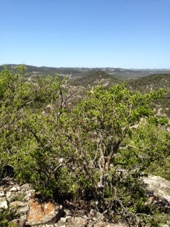
The bulk of the trip was spent on the Blue Ridge Parkway, which is a target rich environment from a SOTA perspective. The drive along the Parkway is beautiful all by itself, especially this time of year with the leaves starting to change. The Parkway is a winding road, with a speed limit of 45 mph, but because of the scenery you are tempted to drive slower. I highly recommend it.


From a SOTA perspective I wanted to activate as many summits as I could in a 2 1/2 time frame. I had been wanting to do this trip for over a year and finally found a hole in my schedule and some decent weather to make the trip happen. I wanted to activate summits in both Tennessee and North Carolina as these would be new SOTA Associations for me to activate. I had some frequent flyer miles on Delta Airlines that needed to be used so we flew into Knoxville, TN. The Smoky Mountains are just a short drive south from there.

I was able to activate eight summits, seven of which were 10 pointers with the other being an 8 pointer. In order of activation they were:
Greentop                                   W4T/SU-076
Clingmans Dome                      W4C/WM-001
Bunches Bald,                           W4C/WM-013
Waterrock Knob,                       W4C/WM-004
Black Balsam Knob                   W4C/CM-005
Mount Pisgah                             W4C/CM-011
Mount Mitchell                          W4C/CM-001
Richland Balsam                        W4C/WM-003

My XYL accompanied my on this trip. She is in great shape and is very helpful setting up and tearing down. Because she was with me and could carry the Alex Loop, my station consisted of Yaesu FT-817 with the 3000 MAh rechargeable battery, Pico Paddle and Alex Loop. The Alex Loop is easier to manage on crowded summits and worked well.

My operating strategy was simple, start on 20m and run the pile-up until I get several unanswered CQ's, move to 40m and get the local guys and then go to 15m to look for some DX. I had some decent DX on 15m. My typical activation takes around 25 - 30 minutes. Since these activations were during the week, I figured QSO counts would be down, however I would say they were better than I expected with 130 QSO's over 8 activations.

Greentop Mountain W4T/SU-076

This is a drive-up summit with radio towers on the top. I didn't have any trouble with RF in the radio however and had a nice activation, 16 QSOs including CU3AA and OE8SPW.

Greentop Mountain


Clingmans Dome W4C/WM-001

Clingman's Dome is a tourist attraction. While it is mostly a drive up, there is about a 1/2 mile hike to the top. Walking past all of the out of shape tourists, I felt rather fit. The trick for the operation is to avoid the crowds. I went to the left of the observation deck and down a path to a clearing next to a air monitoring station and some solar panels. Nice and quiet, away from the crowds and as you can see below, a very nice operating position. 14 QSO's from here.

Operating Position at Clingman's Dome

Bunches Bald W4C/WM-013

As much as Clingman's Dome is a tourist attraction, Bunches Bald is not. It's off the beaten path on the backside of a campground. Got to SotaWatch for more details, but at the back of campsite #14 there is a faint trail to the summit. The hike is probably less that a 1/4 of a mile, but it is through some fairly dense woods/undergrowth, however the trail makes it easier. The summit is very small, so I wouldn't count on two different stations if you do it with someone. I made 27 QSO's from here including EA2LU and F5UBH.
Benchmark on Bunches Bald
Operating from Bunches Bald


Waterrock Knob W4C/WM-004

Waterrock Knob has a visitor center, toilets and a nice trail to the summit. While the trail is nice its a challenging little hike, not too long, but steep in places. Wonderful views from here. 16 QSO's from here including EA2LU, EA2IF and CU3AA.

View from Waterrock Knob

This finished off the first day. As you can see from the pictures, the weather was glorious and the scenery fantastic. The XYL and I finished off the with a nice pizza pie.


Black Balsam Knob W4C/CM-005

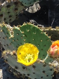
This is a unique summit for the area in that there are no trees on top. I'm sure there is some reasonable explanation but I didn't talk to anyone who knew. I would have guessed that this summit would have "bald" in the name since it has no trees, however, it's a "knob". Bunches Bald, is anything but bald as it has lots of trees and undergrowth on the summit. Go figure. From the trailhead this is probably a 2 mile roundtrip but not a bad hike at all. Because there are no trees on the summit you can see for miles and miles. Beautiful!! 22 QSO's from here including EA2LU and DJ5AV.

Operating from Black Balsam Knob

Mt. Pisgah W4C/CM-011

This is a classic hike in the region. It's 3 miles round trip and gains 750 vertical feet, however the first third of a mile is relatively flat, so most of the vertical gain comes over the last mile. The trail is well shaded, but the trail is rock laden, be sure to wear supportive shoes. Pisgah is a summit that will, at most any given time, have 5 -10 people on top. There is an observation deck, however, based on N1EU's recommendation, I crossed under the tower and operated from the other side of the tower opposite the observation deck. I made 15 QSO's from here including a couple of EA's.


Operating from Mt. Pisgah
My XYL Cris on the trail to Mt. Pisgah


Mt Mitchell W4C/CM-001

Mt. Mitchell is located in Mt. Mitchell State Park. The mountain is the tallest mountain east of the Mississippi. There is a nice road to just below the summit, which is just a short walk away. This is another summit with an observation deck and as before I walked to opposite side of the summit from the deck. I found a nice flat rock to operate from. I made 16 QSO's from here including CU3AA.
Mt. Mitchel Benchmark
Operating from Mt. Mitchell

Mt. Mitchell Summit
Mt. Mitchell finished the second day. We were tired and had dinner at the restaurant just down from the summit. The restaurant food was delicious and the views incredible.
Friday morning, the third day of the trip was forecast for 80% chance of rain. I had a plan to do Richland Balsam if I could get there before the rain did.
Richland Balsam W4C/WM-003
Visibility on the Blue Ridge Parkway was near zero in places and a rain storm was approaching from the west. I was racing the weather to get this one in before it got too bad. It took a little time to find the trail head because of the fog, but we finally found it. The trail is probably .6 miles one way through some dense forest.  We arrived at the summit with only the wind and foggy mist to deal with, but after the first QSO, the rain started. My XYL, what a trooper she is, was holding the umbrella while I hastily tried to qualify the activation. So I was sitting in the rain after 3 QSO's in log, N7UN, NE4TN and W2CKL. It was around 1245z, a little early for the chasers in the west and this was a work day as well. I called CQ for what seemed like an eternity trying to get that 4th QSO. I switched to 40m from 20m, called a couple of CQ's and then the golden answer, de N4EX. Hallelujah!! Another quick QSO with N4MJ and I QRT'ed as the rain intensified. We packed up and happily, at least me, headed down the mountain in the rain.
Operating from Richland Balsam just before a rain
Departing Richland Balsam in the rain
What a great trip, lots of SOTA points and lots of beautiful scenery and even some adventure.

Tuesday, September 9, 2014

Miscelleneous

It's been over a month since my last post. The day job, busy weekends and yes even a little radio have kept me occupied. I won't bore you with the non radio stuff, but I'll try to hit the highlights of the last few weeks.

SOTA

I've been on a couple of SOTA excursions. The first was mid-August to the Davis Mountains in West Texas. If you have never been there, it is an oasis in the middle of a desert. With mountain elevations in the 6 -7,000 ft. ASL, the climate is much closer to a summer alpine climate than a desert climate. Afternoon showers keep the entire area lush and green. I partnered with Mike,  KD5KC on this trip and did three summits, Pine Peak W5T/DW-003, Summit 6641, W5T/DW-018 and Locke Mount, W5T/DE-003. Locke Mount is the home of the McDonald Observatory.

Pine Peak was a first activation for that summit. It is located within the Nature Conservancy boundary, It is open to the public a couple of weekends a year, so we made sure to be there that weekend. It is a pure bushwhack with no trails to the top, so we had fun making a path.

AD5A on Pine Peak Ascent
 
 
Over the Labor Day Weekend I was able to do three summits in New Mexico. I didn't take any pictures, but had a great time with Alan NM5S activating Cerro Vista, W5N/SS-010, and Cuchillo De Fernando, W5N/SS-013. My daughter-in-Law, Kat, wanted to do a hike, so she accompanied me on an ascent of Summit 9700, W5N/PW-018.
 
I've now crossed the 600 point threshold on my way to the 1,000 points required to earn the Mountain Goat award from SOTA.
 
 
New Radio
 
I bought a used X1M Platinum, the 5 band QRP rig from China. I will need to play with it a little more, but so far I'm impressed. For the price, it's a nice rig. I suppose the jury is out on durability, but time will be a good test for that. It's SSB and CW, smaller than the FT-817. It has 80,40,20,15 and 10m bands. However it has the ability to transmit on the other bands, but the filtering would need to be added. I'm sure there are tons of mods for this radio.
 
I will try to catch up over the next few days.


Friday, August 15, 2014

North America SOTA Activity Weekend, Setptember 13-14


North America SOTA Activity Weekend 2014, September 13ths and 14th, is a casual event involving tiny battery-powered radios on mountain summits.  It i s not a contest but is intended to introduce "Summits on the Air" to newcomers with home stations who try to work summit operators during one or two days. There are no rules regarding power levels, modes or number of bands worked, but please be courteous when more than one station is trying to talk to a SOTA operator on a summit.  The SOTA operators have just climbed mountains as high as 14,000 feet; they use low power; and they don't receive on split frequencies.
 
Check SOTAWATCH.org to spot who is on which mountain.  Summits are numbered, and you can hover your cursor over the number to see the name and point value for each summit.  Expect the website to show activity near 7.032, 7.185, 10.110, 14.342, 18.095, 18.155, 21.350, 24.905, 24.955, 28.420, 146.52, 446.00, and 61 Khz up from the bottom of 20, 15, and 10 meters CW.  Participants are invited to collect points toward certificates and trophies offered by the twelve-year-old international SOTA group (SOTA.org.UK).  As we learned in past years, this is a barrel of fun for both hill climbers and home operators.  See you then. 

Thursday, August 7, 2014

Rocky Mountain Rendezvous

I was fortunate to attend the SOTA Rocky Mountain Rendezvous that occurred from July 31 - Aug. 3 in Buena Vista, CO. This year's Rendezvous was a no-host affair with informal gathering of SOTA Activators. Participants consisted of  locals, visitors in rented cabins, campers, etc.... It was a great time. The group that I was a part of rented a house about 12 miles outside of Buena Vista and little did we know there were two SOTA peaks within a 5 minute drive to the base of the mountains. Staying in the rented vacation home were Fred KT5X (aka WS0TA), Guy N7UN (ask NS0TA), John K1JD, Doc K7SO, Alan NM5S, Curtis KC5CW, my grandsons Reid KF5GYE and Boogie KF5GYD (both General Class), my XYL Cris KC5HZQ and myself.. Camping, about 5 minutes away at the base of Kaufman Ridge, was Steve, WG0AT along with Acorn and Barley.

We had a Dutch cookout on Friday night which attracted all the finest people including, Bryan N0BCB w/XYL and friends,Walt W0CP w/XYL,  Dave NN5K w/XYL. Seems like some others, but these are who I can remember. We had a great time grilling burgers, steaks, brats, etc... and swapping SOTA stories.

The RMR coincided with the 14er event put together by Bob K0NR, who stopped by the SOTA house on Saturday night along with his XYL Joyce, K0JJW. The event is an annual event (ham14er.org) which encourages hams to actuvate one of the 14,000 ft. summits in Colorado. As a SOTA chaser and activator, it is a cool event with lots of activity on both HF and VHF.

While in Colorado I was able to active 3 Summits, Kaufman Ridge (10,700 ft. ASL) W0C/SP-081, Horseshoe Mountain (13,900 ft. ASL) W0C/SR-064 and Mt. Sherman (14,034 ft. ASL) W0C/SR-061.

My grandsons and I were fortunate to be able to climb Kaufman Ridge with Steve, WG0AT and he two SOTA Goats, Barley and Acorn. We had a great hike and my grandsons loved interfacing with the goats. Steve did a video of our climb and it can be found at the link below.

https://www.youtube.com/watch?v=EcWGh7Wl3Gw


                                                               KF5GYE (Reid), Barley and Acorn on Kaufman Ridge


                                                          K1JD and AD5A on Mt.Sherman, 14,034 ft.


                                                             KF5GYD (Boogie) on Horseshoe Mt. (13,900 ft. ASL)


                                                      Panorama from Horseshoe Mt. (13,900)

It was a great trip and something all SOTA activators should consider doing.

Wednesday, July 23, 2014

The Solar Superstorm of 2012

As we hams bemoan the fact that sun spots are sparse currently we can't forget the power of the sun. Below is a link to an interesting article, recently published, and  a video on what could have been a disastorous Coronal Mass Ejection (CME) in April of 2012.

http://science.nasa.gov/science-news/science-at-nasa/2014/23jul_superstorm/

It never hurts to have a back-up plan.

Monday, July 21, 2014

After 25 Years

Last February I celebrated 25 years in Amateur Radio. Unlike many who were licensed at a  young age, I didn't get my ticket until I was 32 years old. In fact I recieved my license the same day that my then 12 year old son,Michael received his. We had consecutive calls, KB5ILS and KB5ILT. We subsequently upgraded to extra and received AB5EA and AB5EB. My son kept the later call but I recieved the vanity call AD5A in 1996.

As a teenager my cousin exposed me to shortwave listening. As many of us will say, it was magic to be able to sit in my bedroom and hear signals from around the world. I was mesmerized. I couldn't wait for the mailman each day to see if a QSL card might arrive. However, there were no local hams, learning morse code seemed impossilble, so I never pursued my ham license until years later, when I came across a Gordon West course in the local Radio Shack. The course cover proclaimed that a novice license was good for 10 years and you could talk on 10 meters. I bought the course, my 12 year son listened along as I did, we learned the code together.

So fast forward 25 years, what has changed? I supposed in many ways things have changed a lot. Things like:

- Internet
- Email
- Enhanced Digital Modes
- Online Confirmations
- Equipment functionality

I'm sure I'm missing a few things, but the efficient access to information is much easier now. QSL routes used to be one of the great mysteries of the world, in fact, INDEXA used to have a net on 14.236 that dipensed the lastest QSL route news. Setting schedules required weeks/months of letter writing. Increasing your DXCC count meant turning the dial, find the pile-ups and then back down to figure out the split, find which DX station might be on and then jumping into the fray . Logging was manual and data mining your log for forgotten contacts was a laborious task, but just as rewarding. DXing news came in weekly newletters not daily emails.

But there are some things that haven't changed:

- The concern over how to fund expensive expeditions
- Frequency cops
- QRMer's
- Complaining about the cost of getting a real QSL card
- The thrill of receiving that QSL card
- The excitement of a new one
- The magic of wirelessly communicating around the world
- Dayton, Friedrichshafen, DXCC, IOTA, WABA, etc....

Like some many things, the more things change, the more they stay the same.

Here is a toast to the next 25 years, God willing.


Saturday, July 19, 2014

Who Needs Sunspots

I read that July 18th was the first day without sunspots since sometime in 2012. That's not a good sign for sure. I'm definitely not a solar expert, but I do know that zero sunspots is bad for propagation. That said, last night I worked VK5CZ at 0124z on 15m operating QRP from a summit in Australia.Then this morning I worked GW0PEB/P on 15m from a summit in Wales and a couple minutes later snagged HB9BCB/p on 17m from a summit in Switzerland. Not bad for having a spotless sun. Who needs them anyway?

Just in case, let's hope a few show up:-)

Sunday, July 6, 2014

European Vacation - Friedrichshafen

I am flying back to the US as I type this. Obviously I will have to wait to publish it when I get home, but I thought I would write these thoughts down while they are still fresh. I have been writing a little about my trip to Europe, but the trip has been very busy and I have gotten behind. So, I will go back in time a few days to catch up.

One of the reasons for this trip was to attend the Friedrichshafen Ham Fair. I was attending the convention for the first time and I was not disappointed. The Ham Fair has a large hall of vendors with all the major radio brands and the latest gadgets, a nice stream of lectures on a wide variety of topics, a nice flea market full of classic gear and hard to find items. But best of all the the opporunity to renew acquiantances with old friends get acquainted with new friends.


I was able to make acquiantances with some SOTA  guys from across the pond. In the picture above from the left, HB9DOT, HB9CST, MM0FMF (Andy from the SOTA MT)                                                , and myself. A tradition at Friedrichshafen is for the SOTA guys to meet at the QSL card wall at 12:00 noon on Saturday.

                                               
                                                One of the Flea Market Halls

A few things about the convention were notable. First of all, most of the national societies from Europe have booths there. Only a few had meaningful displays, but they all flew there flags proudly. Additionally          ,       in the flea market, there was an abundance of surplus WW II vintage radio gear. When you think about it, it makes sense. Only a small percentage of the gear used in the war made it's way back to the U.S. There were some very interesting pieces of equipment. You could have purchased a completely restored Enigma machine for 33,000 pounds sterling . The Enigma was a device that was used by the Germans during the war to code messages. There was a huge effort by the Allies to figure out how to decipher these coded messages. There is a museum commemorated that effort at Bletchley Park in England. 


                    The Enigma Machine

          An Interesting Piece of Military Radio Gear

Lastly, the surrounding area around Friedrichshafen is beautiful. The town sits on the shores of Lake Constance. You can set on the shores of the lake and see the mountains of Switzerland and Austria.

For the American visitor to Friedrichshafen, you can feel comfortable that there is enough English spoken to get by on most things. However, it is wise to study a little basic German, expecially if you will rent a car, to understand traffice signs and to figure out menus. That said, it is not a big problem. The program of lectures will let you now what language the sessions are in, so you don't have to wonder if you can understand the presentations,

It is a very worthwhile trip for many reasons. I wiould highly recommend it.

Saturday, June 28, 2014

European Vacation Part 2

I was too busy and tired yesterday to update my blog, that's because it was a busy day. I attended the Ham Fair in Friedrichshafen for the first time and was favorably impressed. The Ham Fair is very well organized and in addition to the goodies I was able to meet some old friends and make some new ones.

Another thing on my mind for this trip however was to activeate three local summits. My primary decision was when would be the best day to do it. The forecast for Saturday was 50% chance of rain and Sunday was 100%. This made the decistion easy. So after lunch, my XYL and I went back to the hotel room, changed into activatoion clothes and headed out. My plan was to activate three summits:

DM/BW-348     Gehrenburg
DM/BW-349     Aacheck
DM/BW-350     Rinkenburg

All summits are within a 20 mile radius of Friedrichshafen. I activated them in numerical order.

I won't belabor the activations. They went smoothly for the most part, but a few observations. First, the surrounding area is beatiful. The drives down the narrow roads and paths that have existed for centuries certainly has an Old World feel.

      Summit of Gehrenburg, Summit Rock in Background

                            Summit of Aacheck

           Operating from Rinkenburg

All three of these mountains have large summits. The areas are heavily forested with plenty of nice places to operate. The last activation, Rinkenburg was heavily was more dense that the other two. I choise a place just below th summit in a meadow thath had been cleared by logging. As you can see in the picture, I used a stump for a shack desk.

Another lesson learned is that 40m is the best SOTA band for Europe. Forty metters defiinitely attracts  the most chasers and 20 meters is much less productive, 34 of 51 QSO's made in total or 66% , were on 40 meters.

So it was very good day. Friedrichshafen and SOTA points, enough said.

Thursday, June 26, 2014

My European Vacation

I am writing this from Zurich. This is the first of 11 days in Europe, a trip has a heavy radio theme. Tomorrow the Ham Fair in Friedrichshafen get's kicked of and I will be there. This will be my first trip to Europe's largest amateur radio event. I am excited about meeting some friends I've never met.

Next weekend is the 50th Anniversary of the IOTA Program. A celebration and conference will be held at the Beaumont Estates in Windsor, near London. I have participated in IOTA for over 20 years and will see a lot of old friends there.

I also want to activate a few summits as time allows, which brings me today's highlight. Even though I am jet lagged, I managed to activate Altberg, HB/ZH-015, which is worth 1 point. This summit has been activated 613 time counting my activation today. When I saw that, I thought this must be a drive up and an easy one at that. While this is not a difficult summit, it does require a 2 mile +/- roundtrip and 300 feet elevation gain. Very nice trail and a nice walk.

We had an interesting encounter with three elderly guys on the trail. None of them spoke a word of English and the only German I know it Guten Tag and no spreichten Duetsche. So imagine me trying to explain what I was doing on their mountain. I did finally get the concept across that I was a ham. I'll mispell this but is something like amateurfunk. We had all heard that word. The next obstacle was to explain my morse key. The term "morse code' met with blank stares, but when I said, "you know dit dit a di di dit". Ah, "morse' ya. They were having as much fun with it as I was.

My XYL, but with her camera, so we can't download them to iPads, but I did take a picture of my travel right. An MTR, 13' telescoping pole, 9V battery, ear buds and a micro key. I managed 12 QSO's and activated my first EU summit and my first HB9 summit.


Monday, June 23, 2014

SOTA Therapy: Five Summits, Two Days

I am a week delayed in documenting this adventure, however, I had to write about it. I went back to my QTH near Santa Fe on Father's Day weekend for some SOTA therapy. I needed to fuel my addiction. There is a great SOTA community in Santa Fe and the surrounding area. The area boasts four SOTA Goats (SOTA Progaram Activator Award), KT5X, KE5AKL, NM5S and the most recent K1JD. Needless to say any non-goats must understand that there are certain expectations. Accordingly, I hooked up with Doc, K7SO on the weekend to try to gain some ground on attaining, Goat Status.

On day one, Saturday, we activated three summits, Don Fernando (W5N/SS-024), 10900 (W5N/SS-019) and Greenie Peak (W5N/SS-015). These are all 10 point summits. My XYL, Cris, was also along to provide support and take few pictures.The equipment for the day was an FT-817, 20/40m EFHW for me and Doc had a KX3 with a 43 ft. random wire and a  9 to 1 balun. The weather was nice, clear to partly cloudy skies with 30 mph winds. The windy conditions put a haze in the air which dimmed the views a bit, but still not a bad day to be in the mountains.

The first two summits are east of  Taos, NM. Doc and I had done these summits before and with the coordinates where to park, getting these summits activated was a matter of course. Each requires relative short hikes to the top, but bushwhacking is the order of the day, with the ascent of Summit 10900 being the most diffiicult of the two. There are lots of downed trees that have to be navigated.

The main obstacle of the day was a recently fallen tree that blocked the road to Summit 10900. Not worry, my Jeep was able to get around the tree with a little off roading. A longer wheel base vehicle would have had trouble getting around. BTW, the jeep came in handy all day long, the roads we travelled had sections that the 4WD and high clearance came in handy.

We did see some wildlife during these activation, including several Elk, Whitetail Deer and some turkey.

Getting to Greenie Peak was more of challenge than we expected.  Greenie Peak is near Red River, NM, which is an hour plus drive from Summit 10900. I had done the peak in the past, but a friend had taken me there on a Razor, a two passenger ATV, and I didn't pay much attention. Consequently when the GPS sent us up the wrong road I willingly followed. This road was a 4WD only road, with warnings, and a sign that said "Exploration Road". Well, we were in search of Goat status, so onward and upward. The road was a one lane, rock filled, steep, hairpin switchbacks to a small summit only big enough to turn the Jeep around on. Sorry Doc, but this is not Greenie Peak. Back down we went. Finally found the road, made the Greenie Peak summit. To expedite the activation we only set up one rig and Doc and I alternated contacts. We worked the pile untill CQ's went unanswered and called it a day.

I had left my house at 7:30 am that morning to drive north to pick up Doc and finally got home that night at 10:30 pm. A 15 hour day of SOTA therapy. I was tired, but I did feel good about getting 30 activator points for the day.

Sunday was a new day, with two summits on the agenda. Barrillas Peak (W5N/PW-022) and Bear Benchmark (W5N/PW-014).  Doc was using this KX3 set-up again, but I swithed the the AT4-S, KD1JV designed CW only radio. The weather was a duplicate of the day before, but the wind had diminished considerably.

The hope was to get these two done and get a home alittle earlier. Barillas went off without a hitch. There is a firetower on top, with nice views. Propagation was good, but it was Father's Day, so I think a few of the chasers were occupied with other activities.

Getting to Bear Benchmark proved a little more challenging. My GPS is set-up for the shortest route which is good most of the time, but not for this day. We followed a road for several miles only to come to a locked gate with "No Trepassing" signs all over it. Bummer. It was getting late in the day and I felt that we wouldn't make the summit in time. We turned around, somewhat disappointed and headed back down. However, when we got back to the main road, I wanted to find the right road at least. We reentered coordinates and the GPS point us a different direction, which to make a long story short, was the right direction. Once on the right road, we decided to go for it and when finally reached the firetower atop Bear Benchmark, the determination was rewarded. We, again, only set-up one station, and took turns calling CQ until we had worked down the pile.

I made it home just in time to watch my favorite basketball team, the San Antonio Spurs put a beat down on the Miami Heat and win the NBA Championship. A good day indeed.

Below is a brief  video of our adventure. I must give credit to Cris who gets credit for putting this together.

Monday, June 9, 2014

ARRL Centennial Paddle

I received my ARRL Centennial Paddle recently. It is a Vibroplex paddle with my call and serial # on it. Very nice paddle.

ARRL Centennial Paddle Serial # 030

I hooked it up and it has a very nice feel to it and it's a great momento of 100 years of the ARRL.

Wednesday, June 4, 2014

KX3: Cool Go Box

I just came across this on the internet the other day, but I thought it was a very cool way to package the KX3 for portable operation.


Check out www.oe2atn.at/tom/gobox

If  someone would commercialize this, I think it would be very popular.

Friday, May 30, 2014

Why Do I Like Operating QRP From Summits?

I have given this question a lot of thought. I've been licensed since 1989, that's 25  years of very active operating. I'm #1 on the Honor Roll, over 1,030 IOTA's confirmed, 5BWAZ, 9 Band DXCC, etc... So, as you can tell, I love the hobby. Given all my ham radio acheivements and activities I can't recall being so enthused about any part of the hobby as I am about the Summits on the Air program. So why is that? I came up with a few thoughts.

I enjoy QRP because it fits my minimalist philosophy of life. What is it that I really need to exist? Operating QRP is like catching a 10 lb. bass on 3 lb test line, it's like sleeping under a lean-to rather than a tent, using an EFHW instead of a beam, it's like David versus Goliath. In short, its a challenge to begin with and thrill when you succeed.

I like managing the gear. I'm always looking for better ways to manage a summit activation from logging to power supplies to antennas to radios. I 'm always looking for the lightest, most efficient approach.  I like that no two activations are exactly alike. Deciding where to set-up, which tree has the best antenna support characteristics, where is best protection from the elements. The shack at home changes very little over time. It's almost boring.

I like the planning, topographic maps, coordinates, routes. I like the exercise, the incentive to stay fit so that I can enjoy what nature has to offer regardless of the altitude. I love the views. It makes me feel alive.

I like the points, the sense of achievement, although it's not always the achievement, it's the chase. The pursuit of the goal is what is motivating. I enjoy the chase.

I enjoy the comradarie of like minded indivduals and the SOTA program is very strong in that regard, it's full of people who love the outdoors, who enjoy QRP and like the challenges of both.

I just had to write it down.

Wednesday, May 28, 2014

Music and Mountains

This past Monday was Memorial Day in the US. A day to remember those who paid the ultimate sacrifice in defense of Freedom and our Country. I am grateful for the dedication and patriotism of these Americans.

Memorial Day Weekend is therefore a Holiday weekend that finds many of us enjoying a three day weekend. The weekend was busy and memorable one for me. The weekend began with a 300 mile drive to play a show with my band, The No Refund Band, at a venue in Crystal Beach, TX. Crystal Beach is on the Bolivar Peninsula, east of Galveston Island on the Texas Coast. We had a great show there. (You can check out my band at norefundband.com )

The next morning (Sunday), my XYL Cris and I got in the Jeep and headed to the Ouachita Mountains in Oklahoma. This would be a 430 mile drive with the purpose of getting as many SOTA points as possible. The drive from Houston was very nice. North of Houston you take Hwy. 19 which goes through the piney woods of east Texas. Of course Texas is a big state and on this highway alone I went through Palestine, Athens, Canton and Paris. The road is nice and the speed limit is 70 - 75 mph and the traffic was light. As long drives go, this one wasn't bad.

The Ouachita Mountains cover southeastern Oklahoma and west central Arkansas. Along with the Ozark Mountains, the Ouachita Mountains form the U.S Interior Highlands, one of the major mountainous regions between the Rocky Mountains and the Appalachian Mountains. It is a beautiful area that is very green and lush with mountains and valleys that induce tranquility.

From a SOTA perspective I had done my research to find the most efficient route to accumulate the most points in relatively short amount of time. I had to be backon Tuesday for work, so I would have 24 hours get as many points as possible.

Sycamore Lookout W5O/OU-005 (8 pts)*

We arrived 20:15 UTC. The summit has easy access from the highway and I was QRV by 20:35. I set up next to the commercial antenna's with no RF issues. The bands were not in good shape and the WPX contest was in full swing. I made 10 QSO's in 25 minutes on 17 and 40 meters and decided to move on to the next one.

Peak 2210 W5O/OU-006 (8pts)*

This summit is just up the road a few miles and the highway is in the activation zone. I did ascend about 50 feet vertically to the summit. I set up just below the summit ridge. Unfortunately, the cell service was spotty and I wasn't able to spot myself. For some reason I wasn't picked up by the RBN network either. Consequently I called CQ for 10 minutes on 17m with no responses. I finally had cell service long enough to get a call off to Fred, KT5X, to ask him to spot me. It still took me 10 minutes after the spot to get my 4 QSO's. Conditions were not good.

Winding Stair Mountain W5O/OU-002 (10 pts)*

Winding Stair Mountain is a nice hike. The trail head is across the road from the Campground and the hike is about 3 miles roundtrip. We encountered a troop of Boy Scouts training for their upcoming 68 mile trek at the Philmont Scout Ranch in New Mexico. Conditions were only marginally better, I made 11 QSO's in 25 minutes.

After this summit we made out way to the Green Country Inn in Heavener, Oklahoma where we had a room. The hotel is a great place to stay if you find yourself in the area. The next morning began early to make sure we got to the summits we planned.

Lynn Mountain W5O/OU-001 (10 pts)*

Getting to this summit is best done with a 4WD vehicle. While a 2WD would make it most days, a 4WD is preferred. The road does enter the activation zone, but I took an ATV trail for the short walk to the summit. This summit is very green and overgrown so I operated from the trail. The weather was overcast and as I left the Jeep it started to rain. We were prepared with rain gear and umbrellas to provide a mini-shack on the summit. There was a light rain during the entire activation. Conditions were a little better and, since the WPX contest was over, 20m was available again. I was on the air at 1335 UTC, so I think I was a little early for propagation and some late rising operators. I made 12 QSO's on 20m and 40m.

Pigeon Benchmark W5O/OU-013 (10 pts)*

This summit is off the same road as Lynn Mountain. The hike to the activation zone is a 2 mile round trip. The trail to the summit is an overgrown ATV trail. The walking is easy with about a 220 foot elevation gain over the mile to the top. The grass on the trail is knee high and it was wet from the rain, so it was a very wet hike. Conditions were much better as I was QRV at 1510 and made 20 QSO's on 20 and 40 meters.

Rough Mountain W5O/OU-014 (8 pts) *

The road to this trail head requires a 4WD. The road crosses the Ouachita trail a about a mile in from Hwy. 259. This is nice 2.5 mile round trip hike with about 500 ft. elevation gain over the 1.25 miles to the summit. The trail is nice. I made 22 QSO's from here.

*Additional details on how to get to these summits can be found on the SotaWatch page for each summit

So there you have it, 54 SOTA points in 24 hours. We had a 500 mile drive home that we made in about 8 hours. So in total we traveled 1,200 plus miles to enjoy music and mountains to make memorable Memorial Day weekend.

A short highlight video can be found here:

https://www.youtube.com/watch?v=NZhGh-XATJ0


Wednesday, May 21, 2014

Call CQ

In todays digital, interconnected, instant access world we have become very dependent on gadgets, websites and notifications. In ham radio, if you chase DX at all, the cluster is probably your primary tool to see who is on from where. I know that I have become accustomed to checking the cluster and if there is nothing interesting I will go do something else with the idea that the bands are dead. There there are times when I check the low end of 20 meters to see what good DX might be available and more often than not, the band is quiet. In the old days, the lower end of 20m was a treasure trove of  DX. I wonder to myself if ham radio is waning in popularity. However ,when a rare country appears, its chaos with unending pile-ups. I am forced to conclude that we are all watching the cluster.

The other night I actually called CQ on 20 meters. In short order I had a nice pile-up of  Europeans, then someone spotted me and the pile-up increased significantly. Everyone must be watching the cluster, thats why the bands are quiet. I think we should all make it a practice to call CQ with some regularity. Tune the bands to see how much DX you can pick up without the cluster. How long will it take you to work DXCC without the cluster, or how many countries can you work in month by calling CQ. If we all do a little of this, the lower end of 20m would came alive again.

Saturday, May 3, 2014

Texas SOTA Trip - The Law of Averages

The "Law of Averages" is a layman's term used to express a belief that outcomes of a random event will "even out" over time. While statistical experts may argue the validity of this thinking in the short term, what do they know anyway. So, you may ask, what does the law of averages have to do with SOTA?

As I have written here recently, the SOTA program recently added 40+ one point summits in South Texas. These summits are within a reasonable drive for me, so I was enthusiastic to activate them and after all, they are all one pointers, they should be easy enough. Just as a reminder for those who haven't caught the SOTA virus yet, point values range from 1 - 10. Oddly enough, 1 is the only odd number used in the valuation scale. Summits can be worth 1,2,4,6,8 or 10 points. Don't ask, I have no idea.


 I've already activated Peak 2002, which was the first South Texas group summit activation. I ended up walking 8 miles for that point. Not to worry though, they can't all be that long. So in the spirit of adventure (and not point accumulation), I planned to activate two of these summits during the International SOTA day and the QRP to the field (QRPTTF) events. My two targets were Bullhead Mountain, W5T/ST-007, and Pikes Peak, W5T/ST-029. Yes there is a Pikes Peak in Texas. The one in Colorado is worth 10 points, the Texas version is worth, the aforementioned, one point.


 I'd done my research and determined that there was a better than even chance these summits would be accessible. While on private land, these peaks are in sparsely populated areas that likely aren't posted. However you never know until you get there.


Bullhead Mountain, W5T/ST-007, is a limestone peak north of Vance (formerly Bullhead) and the intersection of Farm roads 335 and 2631 in far western Real County (at 29°49' N, 100°00' W). The summit, at an elevation of 2,042 feet above sea level, rises on the southern edge of the Edwards Plateau. Local vegetation includes open stands of live oak, Ashe juniper, and mesquite on the uplands and ridges and live oak and Ashe juniper woods on the hills and escarpments. 


The Trail up Bullhead, One of more open areas
Operating from Bullhead Mountain
The best approach to this summit is from the Farm Road 335 side or the south side of the mountain. The fence is deteriorated and it is not posted. The approach on the Hwy 2631 side is posted. This one pointer is no bargain. You will climb 400 feet in about 1/4 mile. Translated, that is steep and the extra bonus is that there are no trails. The slopes are covered with all manner of hard to get through trees and underbrush combined with loose rock to make for an adventurous descent. This is Bushwhacking with a capital B. We did finally summit and had some nice views.
View from Bullhead Mountain

The bands were a little finicky. Only made QSO's on 20 meters. Nothing on 12m despite the RBN hearing me at PJ2T.
Cris and I. Our Jeep is the black speck on the road


View from Pikes Peak
So after the descent of Bullhead Mountain, we made the short drive to Pikes Peak to discover what awaited us there. Pikes Peak, W5T/ST-029  is a mile north of Camp Wood in extreme southeast Edwards County (at 29°41' N, 100°02' W). It rises to a height of 1,904 feet, 470 feet above the nearby Nueces River. The summit was named for Zebulon Pike, whose exploring party passed near it on its return from the exploration of Colorado in 1807. The area's steep to gentle slopes are surfaced by variable soil that supports scrub brush and sparse grasses.

This summit was every bit as tough a Bullhead. There is a road that goes over the shoulder of the mountain which means you only have to climb 300 feet in about 1/3 of a mile. Again, that's steep and again no trails. I operated from the very top of the summit. A nice breeze cooled us down for the now 85F temperatures.


Operating from the Summit of Pikes Peak, Texas
Propagation had warmed up a little by the time we summited, but not much. I doubled my QSO count on this summit, but still most of the business came from 20m. I was able to work five summit to summit contacts which is always rewarding. Portable QRP to portable QRP, from mountain to mountain. Pretty cool. The high bands, 12m and 10m were not really productive, only one QSO on 12m and none on 10m.
We had contemplated doing Wildcat Peak also. Another one pointer, not too far from Pikes Peak, however, we were tired. These ascents and descents were taxing because of the steepness and the full time bushwhacking through brush and the temperatures were warming up. My thermometer in my jeep read 90F when we got down.  We had a nice Texas lunch in Camp Wood. A lunch buffet with Mexican food and Chicken Fried Steak. It doesn't get much better than that.:-)
Cactus Flowers
Texas Mountain Fauna


So, what about this Law of Averages? Well, in the SOTA world there are some easy summits. Some you can even drive up  to the summit or park near the top and take a nice trail a few yards to the summit. I have felt a little guilty about that in the past, getting so many points for so little effort, but no more. The Law of Averages does apply to SOTA. These one pointers were intense, difficult mountains to do. However, I suppose it all averages out. After doing these mountains, my guilt in doing an easy one has disappeared:-)

Photo credits to my XYL Cris, KC5HZQ
Excerpts above were taken from the Texas State Historical Association.